


Extended Research


Extended Research
- Trending
- Comments
- Latest
Au, Cu, Zn
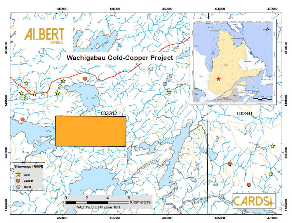
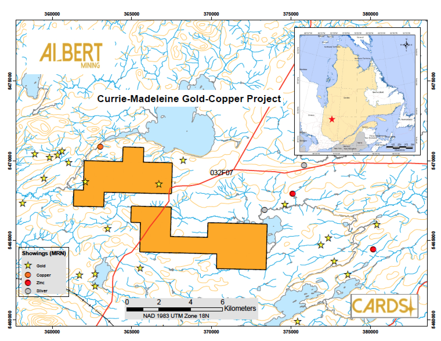
The Currie-Madeleine property covers four gold targets, one cooper target and two copper-zinc targets generated by Albert Mining using its Computer Aided Resource Detection System (CARDS). It consists of 54 claims (CDC) distributed in two claim blocks for a total area of 3030 hectares in the Lebel-sur-Quévillion and Desmaraisville area included into the prolific Archean Abitibi sub-province. Four gold showings grading over 1 g/t and two zinc showings grading over 1% have been reported in historical drill holes on the property. Many gold showings are reported in the area and two gold deposits, Lake Rose and Flordin, are located within 5 km of the property. After the compilation and integration of all geological reports, drilling reports, geophysical ground and recent airborne surveys, including data from adjacent properties, a first phase of exploration program including field reconnaissance was performed on the CARDS generated targets. A high resolution geophysical EM survey will be follow. A detailed analysis of the second phase’s information should be performed in order to re-evaluate the mineral potential of the property and determined the appropriate locations and orientations of drill holes.
SUMMARY
The Currie-Madeleine property lies within theChibougamau-Matagami Archean greenstone belt in the Abitibi sub-province. This belt stretches over 400 km, fromtheKapuskasingstructure to the Grenville front and forms the northern half oftheNorthernVolcanic Zone(NVZ) as defined by Chown et al., (1992). On a local scale, the property lies within a volcano-sedimentary assemblage composed of sub-vertical units oriented E-W to NW-SE, with stratigraphic tops to the north. Three distinct lithologies are present on theproperty: 1) andesitic and basaltic volcanic rocks in the southern section of the property, 2) Taïbi Group sediments in the upper-center section of the property, and3) basalts withplagioclasephenocrysts in the northern section of theproperty.Historical exploration work conducted on theproperty area started in the 1930‟s and allowed for different geological mapping, trenching, geophysical and drilling programs to define the property‟smineralization. Many gold showings are reported in the area and two gold deposits, Lake Rose and Flordin, are located within 5 km of the project. Furthermore, on the property claims, five gold showings grading over 1 g/t and two zinc showings grading over1% havebeen reported in historical drill holes.In April and May of 2010, DIAGNOS Inc. used its proprietary Computer Aided Resource Detection System (CARDS) overtheLebel-sur-Quévillion andDesmaraisville area. The purpose of this study was to identify favorable exploration targets based on the analysis of all available geophysical anddownhole data using artificial intelligence anddata mining techniques. The priority targets, selected based on their high similitude to the known gold, copper or copper-zinc mineralization, led to the staking of different properties throughout the modeling area, including the Currie-Madeleineproperty.The current report details CARDS methodology and modeling process inthegenerationoftarget zones; presents a summarized compilation of previous work; and, proposes recommendations for additional work to assess the potential of the Currie-Madeleineproperty.
View the complete project document – http://albertmining.com/wp-content/uploads/2017/06/currie-madelaine-ilovepdf-compressed.pdf